Document inventory
Review plans, decisions, archives and digital datasets.
 Consortiumof digital technologies
02 / Consortium expertise
We turn fragmented paper plans, surveys and planning documents into a manageable digital foundation for the territory. Geodesy, cartography, registers and public services are combined so communities can use current information for recovery and development.
Who it is for
We work with territorial communities, government authorities, municipal utilities, engineering organisations and responsible businesses.
We adapt the solution to real data, regulations, resources and client-team responsibilities. Delivery covers audit, requirements, design, implementation, training and support.
Scope
Modules are refined after reviewing source data and project goals.
Review plans, decisions, archives and digital datasets.
Create and update plans in official coordinate systems.
Scan, georeference, structure and catalogue documents.
Configure layers, registers, permissions and workflows.
Build one database of streets, buildings and addresses.
Launch geoportals for open data and investment.
Outcomes
How we work
The approach is adapted to the client’s data, infrastructure and responsibilities.
We begin with an inventory of master plans, detailed plans, surveys, decisions, diagrams, address data and digital datasets. Each source is described by date, coverage, coordinate system, legal status and quality. This separates current information from historical records and creates a realistic digitisation plan without repeating work that has already been completed.
A scanned document is not yet a manageable digital resource. Materials must be georeferenced, vectorised where appropriate, described with metadata and connected to decisions and registers. Layers, identifiers and reference lists are designed so information can be updated, searched, versioned and reused in a geoportal, planning cadastre or analytical platform.
Current topography, addresses, planning constraints, land, property and utility information need to work together. This foundation supports site selection, design inputs, impact assessment and coordination between delivery teams. It reduces the risk of designing from outdated records and creates a basis for transparent communication with residents, investors and recovery partners.
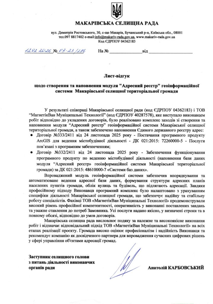
The Novodonetske reference describes surveying and cartographic work, a 1:500 digital topographic base and use of a local coordinate system connected to Ukraine’s official reference framework. A separate letter from Makariv Settlement Council confirms address-register delivery by MagneticOne Municipal Technologies. The website keeps these sources and responsible companies explicitly separated.
Related projects
Each case states whether the experience belongs to the consortium or a specific founder company.
 Experience of MagneticOne Municipal Technologies LLC
Systematisation and practical use of current address data.
View project → Experience of founder companies
Public and internal access to current urban planning documentation.
View project →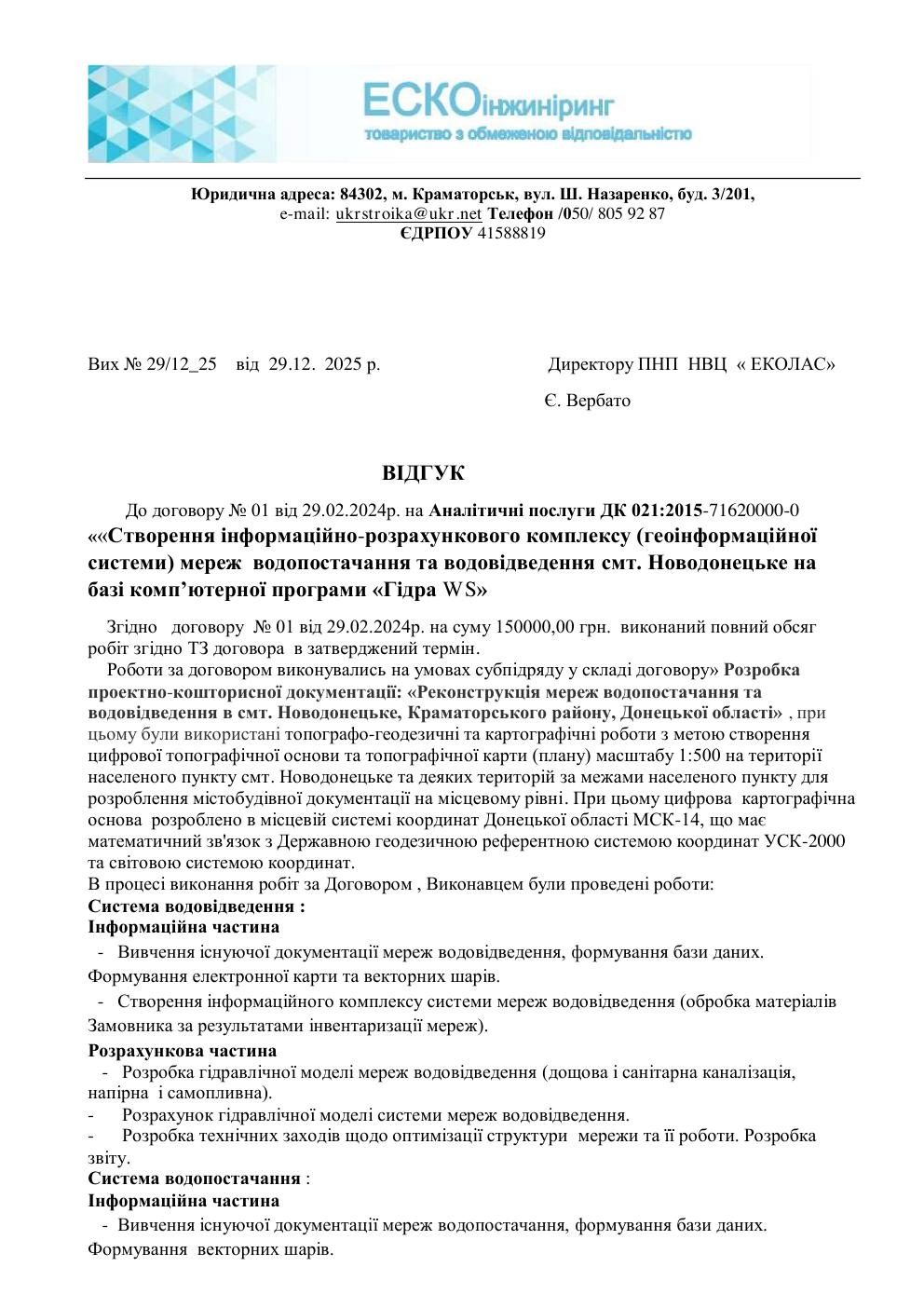 Experience of Ekolas Research and Production Centre
A 1:500 digital topographic base in the local coordinate system.
View project →Documented evidence
Scanned letters open in their original form.
Official letter concerning development of the community address register.
Open document ↗Ekolas Research and Production CentreThe document describes surveying, cartographic work and the digital base for Novodonetske.
Open document ↗Practical questions
Yes. After condition review they can be scanned, georeferenced, catalogued and vectorised where useful.
Yes. Coordinate systems, accuracy and transformation rules are defined for each territory and dataset.
Yes. The public geoportal is separated from the internal environment, and the client controls what is published.
Delivery can begin with one priority dataset, such as the address register, topographic base or planning archive, and expand in controlled stages. We define the territory, sources, legal status, accuracy and users before structuring data and acceptance rules. This provides early practical value without waiting for every historical record to be perfect. The first stage also creates a compatible foundation for a planning cadastre, public geoportal, recovery design, utility management and analytics, avoiding another isolated archive that cannot support wider digital transformation.
IT OTG
Describe the context, expected outcome and timing. We will assemble the right team and propose the next step.
Discuss a project↗